

New Charles River Basin Master Plan
Description
“The Metropolitan District Commission chose Carr, Lynch, Hack and Sandell to produce a master design for the $80 million New Charles River Basin between the old and new dams at the mouth of the Charles River. This was the largest public park project undertaken in Boston or Cambridge in the 20th century. The plan was implemented as part of the new Charles River crossing of Boston's Central Artery project, "The Big Dig". It transformed a former train yard and industrial wasteland into a series of parks connecting the existing esplanades of the Charles River Basin with Boston Harbor. The New Basin paths connect Cambridge to Charlestown with a new bridge across the railroad tracks, and a path across the new dam and locks connects to downtown Boston. Because the new dam includes a pumping station to maintain the river level, it was possible to lower the stone walls defining the new basin by several feet so that the green spaces could terrace down to the River's edge. The master plan was developed in a participatory process with representatives of the Central Artery project, the cities of Boston and Cambridge, and members of the adjacent neighborhoods. Upon acceptance of our Master Plan, CLHS was commissioned to design the first two parks in the New Basin, Paul Revere Park in Charlestown and North Point Park in Cambridge and Boston.
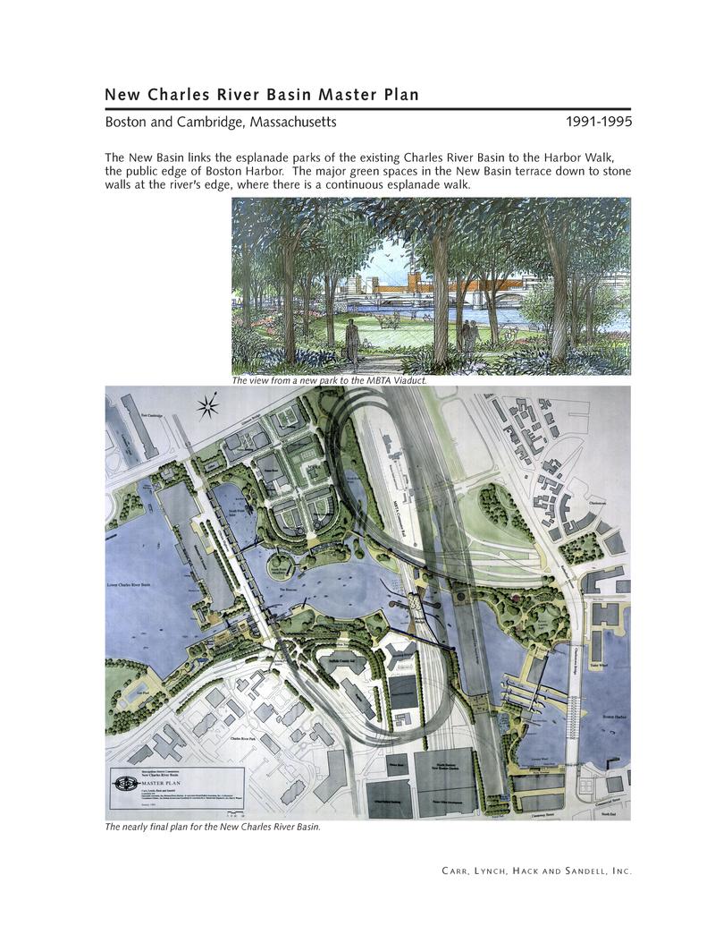
“The New Basin links the esplanade parks of the existing Charles River Basin to the Harbor Walk, the public edge of Boston Harbor. The major green spaces in the New Basin terrace down to stone walls at the river's edge, where there is a continuous esplanade walk.”
