Phoenix Metropolitan Area, Rio Salado Master Plan
2023.029.0154

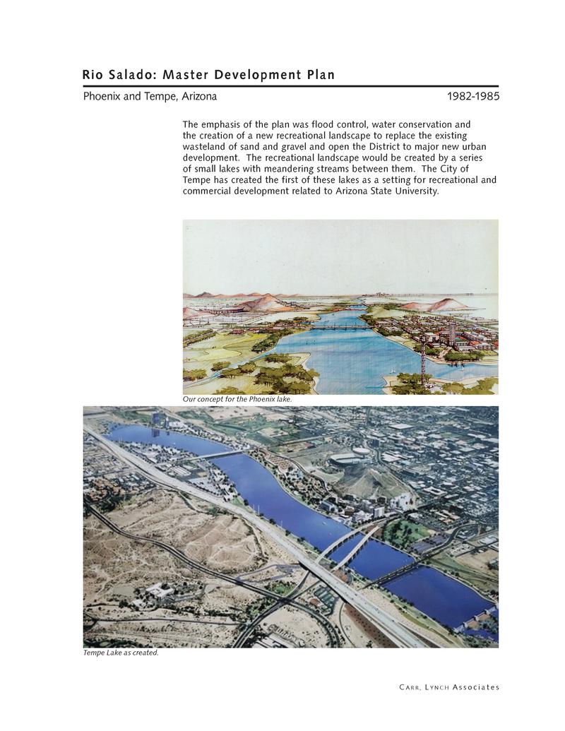
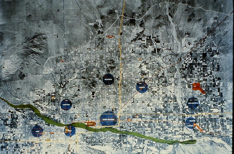
Master Development Plan: "Rio Salado was one of the most ambitious master plans to date for the transformation of a U.S. metropolitan area. The Salt River, which runs through the heart of three cities and two Native American reservations, has periodically flooded up to 100 square miles, making permanent settlement of the area impossible. Upstream dams were built for regional irrigation purposes, interrupting the flow without flood control. The result was a huge wasteland, flanked by sand and gravel operations, open and enclosed storage, and other transient uses. With broad public participation, the Carr, Lynch Associates plan, completed in 1985, proposed creating flood control and a series of shallow lakes with limited surface area (to reduce evaporation), embedded in a landscape of low water desert plants and flanked by new mixed-use urban development. Salt-polluted groundwater together with specially treated sewage would provide enough water without competing with other regional water needs. The project would be paid for by taxation on reclaimed lands along the corridor, together with a small property tax increase for initial construction bonds, and a small sales tax for maintenance. Tempe has implemented its portion and Phoenix and Mesa, after initially rejecting any tax increases, are currently implementing parts of their sections. The emphasis of the plan was flood control, water conservation, and the creation of a new recreational landscape to replace the existing wasteland of sand and gravel and open the District to major new urban development. The recreational landscape would be created by a series of small lakes with meandering streams between them. The City of Tempe has created the first of these lakes as a setting for recreational and commercial development related to Arizona State University."
The Islands: "Carr, Lynch Associates designed a new island at 24th Street as part of its master plan for the Rio Salado Development District. Shaped to accommodate reduced flooding, the island would be accessible to the airport and become the unique setting for special high density, mixed-use development, including housing, a hotel, offices, restaurants, and public recreational facilities. A mix of high-tech industry, offices, and moderate-density housing would be located on the southern riverbank for easy walking or bicycling to work. The landscaped setting of the industrial park would provide recreational areas for use by nearby residents. A second island was designed for an exposition to celebrate the beginning of a new waterfront for Phoenix."
Riverbed Park: "The Park near the Tempe Crossing showcases a characteristic view with a lake, a riding trail, and rapids on the meandering stream, specifically designed for white water enthusiasts. The landscape features a varied terrain that utilizes a rich palette of drought-resistant, low-water plants suitable for each topographic zone of the riverbed."
2023.029.0154

2023.029.folder.043

2023.029.folder.044