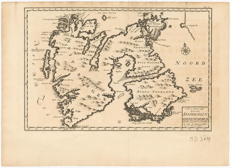
Map of Spitsbergen
Description
Uncolored engraving depicting a chart of Spitsbergen and Stans Voorland. Shoals are marked with small "x" around the coast of the islands. Bays and inlets are marked and labeled in Dutch. The first meridian is noted to be that going through the Canary Islands. From the book "Bloeijende Opkomst der Aloude en Hedendaag Groenlandsche Visschery" by C. G. Zorgdrager.
Related people
Related organizations
P. van Thol and R.C. Alberts
Publisher