
De Veer, Gerrit
Engraver

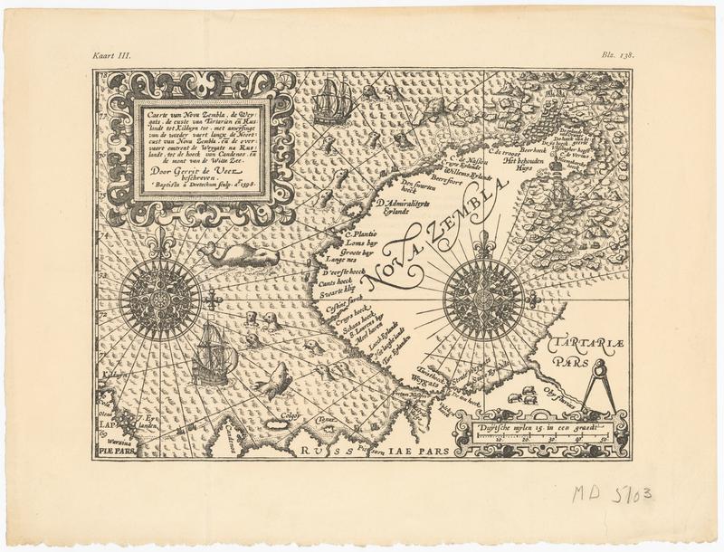
Uncolored woodcut map of Nova Zembla based on Gerrit de Veer's voyage there, and to accompany a later edition of his 1598 book on the subject. Text on the verso reads, "Kaart III. Caerte van Nova Zembla, de Weygats, de custe van Tartarien ende Ruslandt tot Kilduyn toe, met anwijsinge van de weedervaert lancx de Ruslandt, tot de hoeck van Candenos, ende de mont van de Witte Zee. Door Gerrit de Veer beschreven. Baptista a Doetechum sculp. A0 1598. "
In smaller font:
"Het origineel is 244 bij 179 mM [this reference to the original, and the units mM, indicate that this is a later edition reproducing the original map]
De schaal is I: 6.200.000.
Opmerking verdient dat dit kaartje niet indentiek is met Kaart I. Deze is een platte kaart en geeft de kust van Nova Zembla tot aan het Behouden Huis met de door de terugkeerende schepen gevolgde route; gene is een polaire projectie en gaat niet verder dan tot waar de kust van Nova Zembla in 1594 bekend geworden was."
English:
The original is 244 x 178 mm.
The scale is 1: 6,200,000.
It is noteworthy that this map is not identical with Map I. This is a flat map and shows the coast of Novaya Zemlya to the Retained House with the route followed by the returning ships; the former is a polar projection and goes no further than to where the coast of Nova Zembla was known in 1594.