USS MONITOR research - map of Outer Banks, NC
Description
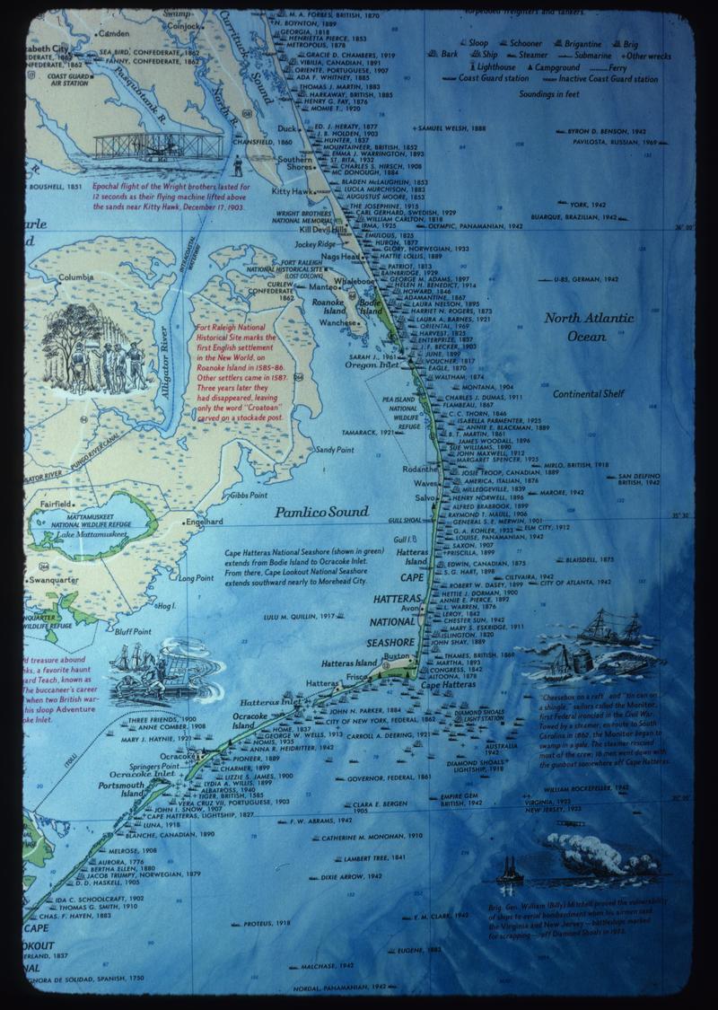
Historical map of the Outer Banks, with indicated the sites of shipwrecks in the region (National Geographic Society map, issued Jan. 1974). (CC)
Inscriptions
- Type
- handwritten blue ink
- Location
- obverse top
- Text
- CAPE HATTERAS - SITE OF MONITOR WRECK
-
-
- Type
- handwritten blue ink
- Location
- obverse bottom
- Text
- EDGERTON
-
-
- Type
- handwritten pencil
- Location
- obverse bottom
- Text
- 32 [in circle]
-
-
- Type
- handwritten pencil
- Location
- obverse bottom
- Inscriber
- Edgerton
- Text
- 4
-
-
- Type
- printed red
- Location
- obverse bottom
- Text
- 32
-
-
- Type
- printed red
- Location
- obverse bottom
- Text
- OCT 75 N12
Related items
There are 2 items related to this object.